Annotated Project Maps
The maps below reflect the geographical extent of the American Milcom network in western Germany and depict the concepts of sectors (zones) and military communities (Milcoms).
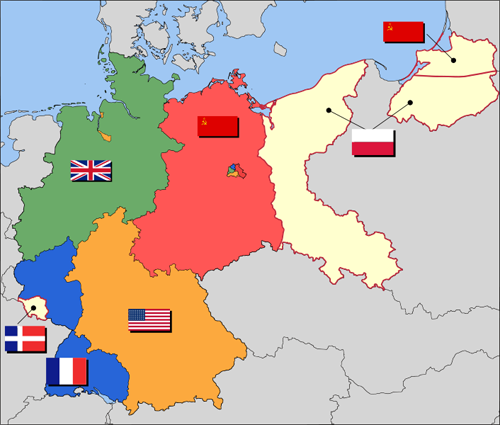
Notes for Map 1 (above):
1. Portions of eastern Germany including East Prussia became new territories of Poland and the Soviet Union.
2. The Allies separated the Saarland from Germany and designated it as a special protectorate of France.

Notes for Map 2 (above):
1. Map depicts only the locations of major Milcoms. Satellite communities are not shown.
2. Unit insignia are used to show areas of responsibility for subordinate headquarters.

Notes for Map 3 (above):
1. The population of military communities included military service members and civilian government employees as well as the family members of both.
2. Every American military unit was a tenent of a Milcom.
